|

Was Sie schon immer Über Australien wissen wollten
finden Sie hier. Unter anderem auch Infos über
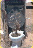
Nationalparks,
Fossicking,
Auswandern,
Reiserouten,
Australien Shop,
Klimadaten,
Wetter Infos,
Geschichtliches,
Geld,
Guides,
Reiseinfos,
Kleidung,
Reisen mit Kindern,
Gefahren,
Bushwalking und vieles mehr ... Mehr Infos finden
Sie
hier.

Hier finden Sie alles rund um das Thema Backpackers.
Ob Jobsuche, Wohnungssuche oder Reisepartnersuche hier
finden Sie Insidertipps, Informationen und aktuelle Berichte
über die Themen
Studieren,
Hotspots,
Ernteguide,
Visa,
WHV,
ORGA,
Aufnahmetest,
Wohnen,
Tourismus Jobs,
Wwoofing,
Farmjobs,
Nanny Jobs,
Strong Jobs und vieles mehr.
Weitere Infos finden Sie
hier.

Australien Land aller
Träume: Seit jeher
lockt
Australien, Abenteurer aus der ganzen Welt an. Das war
der Grund für uns eine Australien Info Seite zu erschaffen
und Ihnen somit die benötigten Infos zu vermitteln. Waren es
früher die Glücksritter, die schnell das große Geld machen
wollten, sind es heute Touristen, die in der
atemberaubenden, wilden Natur Australiens den Ausgleich zum
zivilisierten Leben suchen. Mehr Infos zum Thema Auswandern,
Englisch Test
und wie Ihre
Chancen stehen können Sie
hier nachlesen.

Australien Forum und Neuseeland Forum
mit umfassenden Infos zu:
Backpacker,
Jobs,
Auswandern,
Fahrzeuge,
Gefahren,
Reiseinfos,
Reiserouten,
Geschichte,
Insider Tipps,
Reisepartner Suche,
Australien Tracks,
Kaufen
& Verkaufen ... und vieles mehr. Mehr Infos finden Sie
hier.

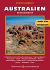
Australien und Neuseeland Shop mit
Hema Maps,
DVD's,
Bücher,
Tauchführer,
Reiseführer,
CD's,
Opale,
Aufkleber,
Souvenirs,
kostenlose Reiserouten,
Fossicking CD Download und
vieles mehr. Mehr Infos finden Sie
hier.

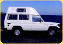
Australien und Neuseeland: Flüge,
Hotels
& Hostels, Standard
Fahrzeuge, Camper,
4WD's

Mit unserem Partnerprogramm können Sie ohne viel
Zeitaufwand einen lukrativen Nebenverdienst erwirtschaften.
Wir bieten
zwei Partnerprogramme (Affiliates)
an. Mehr Infos finden Sie
hier. |